Perry Riffle Trailhead | Wild Camping
United States
Details
- Verified:
- 11 months ago
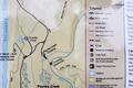
- GPS:
- 40.29410, -122.17842
- Altitude:
- 99.5 masl
- Website:
- None
- Contributor:
-
 pridefamilyadventures

Amenities
- Electricity:
- No
- Wifi:
- No
- Kitchen:
- No
- Restaurant:
- No
- Showers:
- No
- Water:
- Natural Source
- Toilets:
- Pit Toilets
- Big Rig Friendly:
- Yes
- Tent Friendly:
- Yes
- Pet Friendly:
- Yes
Something not right?
Description
iOverlander cannot verify if wild camping is permitted at this location. It is your responsibility to verify local laws or obtain consent before staying the night.
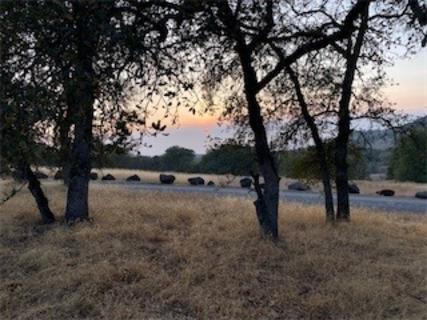
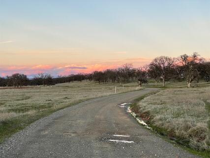
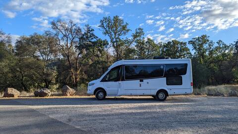
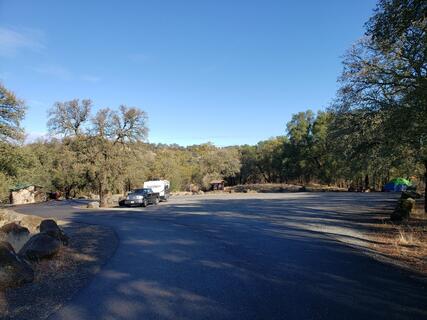
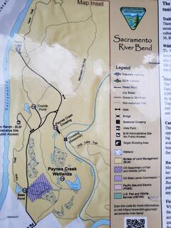
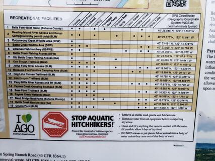
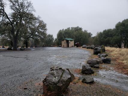
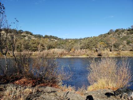
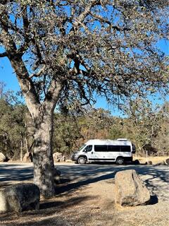
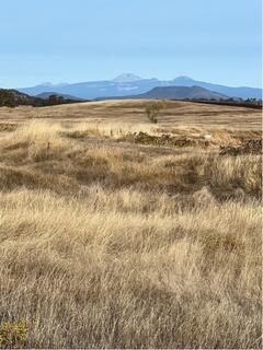
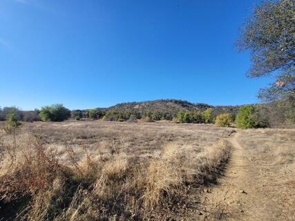
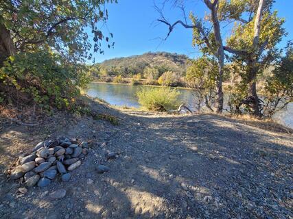
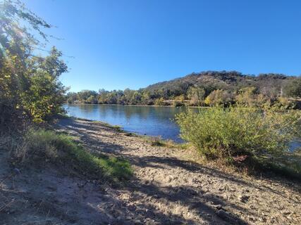
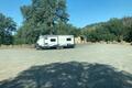
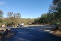
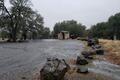
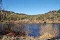
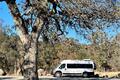
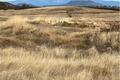
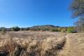
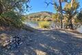
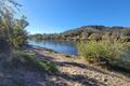
On BLM land. Oak forest and grassland. Just a few miles from I-5 north of Red Bluff. Exit at Jelly's Ferry. Turn on Bend Road. Follow signs to Payne's Creek Recreation Area. Town of Bend is a general store and a few scattered ranches. There are only a few locations in this parcel of BLM land open to camping. Vehicles are not allowed off the roads. This spot is called Perry Riffle and is a large turnaround at the end of a maintained gravel road. A short trail leads to the Sacramento River. Open fires not allowed during summer. No toilets. Must be self contained. Another location nearby (< 1 mile) on road to Massacre Flat CG. Gravel road to Massacre Flat changes to rough 4wd road after 1/4 mile. You can self-contained camp at turnaround where gravel changes to 4wd.
Photos


Why? By checking in after you’ve visited a place you let others know this place is still functional. You can also add or correct any information.
Latest Check-Ins
three permanent looking encampments with not well looking people inhabiting the area. beautiful but didn't feel safe
Report Check-InPulled up their were people sleeping on the ground and people walked around acting drugged out. We left immediately. Don’t waste your gas.
Report Check-InStayed 2 nights, verizon 2 bars in & out so I moved to another spot. Gorgeous night sky, bathrooms & trail to the river that looks like a good spot for tent camping!
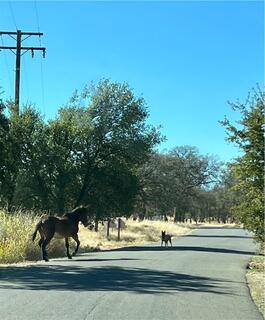
Report Check-InEndroit très calme avec pit toilette tout au bout d’une superbe route agréable à s’y promener dans la campagne. On y a rencontré des chevaux et il y a plusieurs aigles qui survolaient au-dessus de nous. Tout près de la rivière Sacramento. On y a passé deux jours très relaxes à juste entendre le silence. On aurait pu y dormir 14 jours gratuitement.
Report Check-InNice little overnight spot if you’re traveling on the 5! Best for self-contained vans/trucks/RVs because there aren’t that many spots for a tent, but we set up ours just fine. Some picnic tables and a decently clean pit toilet. Beautiful golden hills too! Wish we could have stayed longer to explore the trails to the river
Report Check-InParked at trailhead with 3 other cars. Nice open area to park. Bathroom and garbage cans
Report Check-InGreat spot. Quiet night. I rolled in at dark with only 1 other camper there
Report Check-InI am pleasantly surprised at how peaceful of a spot this is. So quiet and nice. You just follow the pavement til the very end. There were turn offs that confused me because they were gated and closed(and one was called Perry rifle as mentioned in this post) but I kept following the road and ended up at the gravel circle. There are 3 other solo travelers here with their pets, as I am mine. I haven’t done the hikes because I pulled in just before dusk. Very happy I’m going to continue using this app over my 3 month road trip!
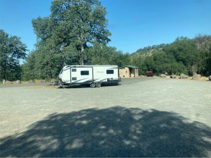
Report Check-InNice, easy to get to spot close to the Sacramento River. The road dead ends at a loop that has a well maintained pit toilet, trash/recycling, and two picnic benches. There were a few rvs when I arrived but my 24’ Skoolie fit no problem. Mosquitos at dusk (to be expected) but otherwise it is a lovely spot. A few river access points so you can have your own spot. A couple trails that go through some wild flowers to take the pup on. Very little trash which was a pleasant surprise. Seems to be a local spot for people to swim their pups, but it was never super busy feeling.
Report Check-InTwo other vehicles parked along the stretch that dead ends at Perry’s Riffle. The quiet and darkness are very appealing and it is only a 15-20 minute drive from the highway. This appeared to be the easiest access and prettiest spot to camp for free until well past Shasta lakes, and the lower elevation and warmer temps made it a good spot.
Report Check-InPlenty of pull-offs and trailhead parking lots. I’m in a small van, but I saw people pulling trailers who seemed to be staying farther in the road (which I believe dead ends about 1.5 miles in). There’s a sign on the road I. That tells you where the public land begins. I stayed for a couple of nights, never had any trouble and the park rangers drove right by me at least 5 times without stopping.
Report Check-InBeautiful land on the way to this spot. At the end of the road there is a gravel lot, big enough to loop around with my teardrop. One picnic table wrapped up with tarp, someone claimed it, probably the car parked near it. Another permanent resident is a mid-size rv. The lot was packed when I came in at 5:15 but still had space for me-I decided to go enjoy the sunset and have dinner at one of the early turnout roads. Many cars left while I was eating-prob 3-4 cars left in the lot. I am going to enjoy my spot then drive out for the night down south a little at the Chevron lot or the Olive Restaurant.
Report Check-Innice spot for the night. we decided not to camp at the actual trailhead and instead parked at a pullout along the road. excellent 4g verizon signal. and yes, there are restrooms and trash cans on the road in.
Report Check-InBeautiful place, easy drive in on paved road. Verizon reception and a few tv stations. Quiet and secluded.
Report Check-InOn BLM land. Oak forest and grassland. Just a few miles from I-5 north of Red Bluff. Exit at Jelly's Ferry. Turn on Bend Road. Follow signs to Payne's Creek Recreation Area. Town of Bend is a general store and a few scattered ranches. There are only a few locations in this parcel of BLM land open to camping. Vehicles are not allowed off the roads. This spot is called Perry Riffle and is a large turnaround at the end of a maintained gravel road. A short trail leads to the Sacramento River. Open fires not allowed during summer. No toilets. Must be self contained. Another location nearby (< 1 mile) on road to Massacre Flat CG. Gravel road to Massacre Flat changes to rough 4wd road after 1/4 mile. You can self-contained camp at turnaround where gravel changes to 4wd.
Report Check-InNice BLM rec area that allows camping up to 14 days, but there are no designated campsites, just a big gravel lot with a paved road into it. More of a day use area with lots of hiking, horseback riding, river access, and tons of birds all over. Some cell coverage.
Report Check-In