Cerro Blanco trailhead from westside | Wild Camping
Peru
Details
- Verified:
- 11 months ago
- GPS:
- -14.83904, -74.86035
- Altitude:
- 882.0 masl
- Website:
- None
- Contributor:
-
 Calderescapes

Amenities
- Electricity:
- No
- Wifi:
- No
- Kitchen:
- No
- Restaurant:
- No
- Showers:
- No
- Water:
- No
- Toilets:
- No
- Big Rig Friendly:
- Yes
- Tent Friendly:
- Yes
- Pet Friendly:
- Yes
Something not right?
Description
iOverlander cannot verify if wild camping is permitted at this location. It is your responsibility to verify local laws or obtain consent before staying the night.
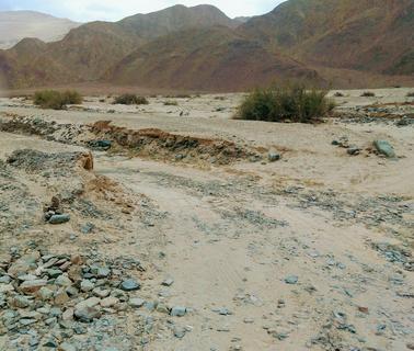
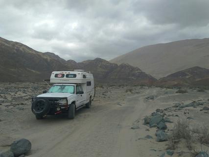
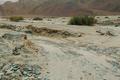
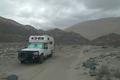
Road to Cerro Blanco trailhead by westside. The road to the trailhead is about 7km long from the PE-30A. It starts just east of the weigh station. There is no sign but there are two wooden posts between two buildings (one looks like a large shrine). At the 1km mark (coordinates are: -14.83586, -74.862 - see first photo), the trail follows a dry creek for a couple hundred metres. We hoped to drive down and park at the trailhead but at about 300m after the creek bed, we came upon a good amount of soft sand and decided with the weight of our rig it was best not to chance getting stuck so we boondocked here. The road to this point does not require 4x4, but high clearance is helpful in creek bed. There are several spots along the road to spend the night. Later we walked to the trailhead and saw that if you can make it through that soft, sandy bit you can go about about another 1.3km but be aware of lots of sharp rocks. Super quiet night!
Why? By checking in after you’ve visited a place you let others know this place is still functional. You can also add or correct any information.
Latest Check-Ins
Did this in our 2wd. It was pretty sandy. To be honest no more sandy after the flags where you stop, if you made it there you can go further. Be aware that it’s pretty soft to park on up there. High clearance useful and good AT tyres advised if you’re 2wd. Beautiful quiet spot.
Report Check-InVery nice and quiet place just a few km of the main road, even if you don't plan on climbing Cerro Blanco. Indeed some sandy patches, up to the point where an old desolate bicentennial flag is flying, it should be doable with 2WD.
No cell service here, but some closer to the road.
Report Check-InWe arrived here without problem with our 2WD. After that point, the road begins to be too sandy.
Report Check-InNice dessert place even if you don't want to hike. There is a path beside the dry river you can follow. Some deep sand sections so probably 4WD recommended.
Report Check-InThe road to the trailhead is about 7km long from the PE-30A. It starts just east of the weigh station. There is no sign but there are two wooden posts between two buildings (one looks like a large shrine). At the 1km mark (coordinates are: -14.83586, -74.862 - see first photo), the trail follows a dry creek for a couple hundred metres. We hoped to drive down and park at the trailhead but at about 300m after the creek bed, we came upon a good amount of soft sand and decided with the weight of our rig it was best not to chance getting stuck so we boondocked here. The road to this point does not require 4x4, but high clearance is helpful in creek bed. There are several spots along the road to spend the night. Later we walked to the trailhead and saw that if you can make it through that soft, sandy bit you can go about about another 1.3km but be aware of lots of sharp rocks. Super quiet night!
Report Check-In