Viewpoint / Western Cross on Crater ridge | Tourist Attraction
Namibia
Details
- Verified:
- about 1 year ago
- GPS:
- -25.87760, 17.77323
- Altitude:
- 1562.4 masl
- Contributor:
-
 www.grimber.de

Amenities
Something not right?
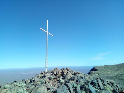
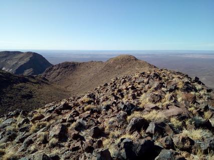
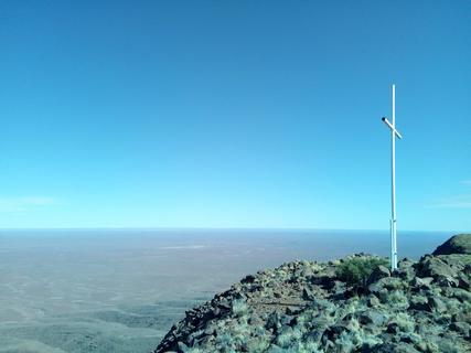
Description
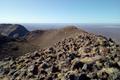
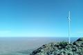
This is the viewpoint / western cross to the plain. Great view. From the "Upper" campsite it is in total 3,1 km to walk (1 - 1:15 hrs). To get there you take the left trail (upwards - right leads down into the crater) when getting to the place where you can see the first time down into the crater (- 1,8 km). After in total 2,7 km you reach the ruins of some old huts. From there you a magnificant view into the western plains. You can walk another
400 m over the stones to the cross. There is another cross further ahead ...and this might lead you also over the ridge to the old observatory (we have not tried).
Why? By checking in after you’ve visited a place you let others know this place is still functional. You can also add or correct any information.
Latest Check-Ins
We hiked to the top of the crater. We did not go to the cross or do the rim hike. It took us 2 hours in total there and back, from the upper camp site. From upper camp site, we followed Maps.me track towards the small waterfall (no water). Just after this, turn left- otherwise the path goes down into the crater instead of up. This still follows the Maps.me track. After a while following the track, you come to a rock with arrows pointing either way. As others have said, these both lead to roughly the same place. But the paths become increasingly hard to follow. We took the left hand path for a short while. Once we were near the top, we just scrambled directly up to the top to catch the sunset. Sunset for us was around 6.35 which meant the last part of our hike down was in the dark, so bring a head torch if you do that and go slow, it was harder going down. Enjoy!
Report Check-In2h30 to go up and down (observatory ruins) from the upper campsite. Very nice view. Alone. Some wild animals. Perfect trail tracks.
Report Check-InThe hiking trail is not difficult for those used to hiking in the mountains and sure footed. The crest trail is not really marked but it is easy enough to pick a route to the cross. The second cross is actually a survey point but worth the trip as the views out West and down to the crater are very good. If you are experienced in mountain conditions you can follow the rim to the West to its lowest point then hike down into the crater follow the river back to the waterfall and regain the trail. A fantastic ridge walk under good conditions. There is no observatory
Report Check-InSet aside at least 3-4 hours with break if you wish to do the crest trail. When you reach the rock that has two white arrow pointing separate directions, both go to the same point and you can make a loop of the top crest trail. If you just want to see the crater, about 1.5-2 hour return is sufficient. Path is overgrown towards crest trail
Report Check-InThis is the viewpoint / western cross to the plain. Great view. From the "Upper" campsite it is in total 3,1 km to walk (1 - 1:15 hrs). To get there you take the left trail (upwards - right leads down into the crater) when getting to the place where you can see the first time down into the crater (- 1,8 km). After in total 2,7 km you reach the ruins of some old huts. From there you a magnificant view into the western plains. You can walk another
400 m over the stones to the cross. There is another cross further ahead ...and this might lead you also over the ridge to the old observatory (we have not tried).