Check-Ins
| When? | Who? | Comment | Place | Location |
|---|---|---|---|---|
|
dex.merenick
|
Great little spot on the river to take pictures and stop for a bite to eat. |
Scenic Round About | 45.50882, -122.67356 | |
|
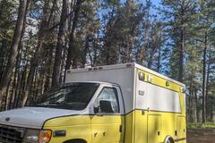
coleandshea
|
as advertised! great free spot to spend a few days. bumpy road but our converted ambulance made it just fine. |
Forest Road 237 | 35.05311, -111.72749 | |
|
||||
|
Chambre avec vue
|
Walmart on Riverside. Asking at the Walmart customer service: the parking lot isn’t Walmart property so we stay overnight at our own risks. |
Walmart parking lot | 45.38488, -75.68015 | |
|
odpotovanja.si
|
Nice spot, more hidden than the other places nearby we checked. There is a narow road that leads even further away, but we didn't check it as we arrived in the dark. |
Off Road 68 | -26.02424, -65.83841 | |
|
fabio__castro
|
Posto bem tranquilo, água disponível no posto e local seguro para pernoitar com estacionamento amplo |
Shell Três Marias | -18.23282, -45.21732 | |
|
||||
|
ryanmvickerman
|
No overnight signs and no other RVs around. I decided not to chance it and rolled down to the Cracker Barrel. |
Walmart Parking Lot | 34.78920, -84.99964 | |
|
brad.springer13
|
Quiet little spot for an overnight. 15 min outside of Cedar City. |
Bumblebee BLM | 37.59699, -113.23735 | |
|
oneendlessroad.com
|
As described, still a great quiet place to stop…! |
Beasely River Rest Area | -22.94899, 116.97777 | |
|
claude.m.bella
|
Trailhead parking lot. 1 bar Bell LTE. Could fit a big rig but not a lot of space. Quiet. Buggy. Good for a nights sleep. No “no overnight camping” signs. |
Carrick Tract Trails | 43.97411, -81.08046 | |
|
clare0rise
|
Very overgrown. If you have dogs absolutely not, tics everywhere. No access to water anymore as the path is filled in with TALL weeds. Also dirty. Also Verizon is 2 bars. But ew. |
Unicorn Beach | 39.55187, -123.42574 | |
|
katherineletts
|
Yes, bumpy dirt roads from about here to Sao Jose dos Ausentes. Once you make it to Sao Jose dos Ausentes, it’s paved, but if you continue on the RS-020 towards Joaquim, it’s gravel again. This time, much better maintained. The worst of it is the stretch around this marker. Google Maps time ETA was correct for us. I wouldn’t recommend these roads, but if you deicide to take them, make the most of it! Plan for a long day through the rural countryside. It is beautiful. |
Bad gravel road under construction causes delay | -28.95428, -50.05471 | |
|
travelingchis.com
|
Nice large pull through right off the main road We didn’t stay but I don’t think you would here too much traffic noise |
Pull thru | 43.80326, -121.53482 | |
|
ersterjuni2005
|
Really friendly checkpoint. They just wanted to know where to go, and how we like Colombia :-) |
Military Checkpoint | 1.65052, -76.25241 | |
|
photosfm
|
very nice place, good for many vr, with pick nik table near water. |
Portage off Route 105 | 45.96118, -66.87533 | |
|
||||
|
DEU NA TELHA DO CARECA
|
Local tranquilo tem um restaurante que pode fornecer energia, água tem uma torneira logo mais a frente da cobertura, no restaurante é possível pedir para chamar o pessoal da secretaria do turismo, pois aqui eles acolhem o caravanismo, se você for autônomo de energia fica sem nem ter que chamar ninguém, tem banheiro 24 horas, pega bem 4g vivo e Tim, talvez outras, mas eu não sei, cidade tranquila é muito boa pra quem gosta de pescar, aos finais de semana dá um pouco de movimento, e o comércio é bom, e a natureza é linda isso sem contar as incontáveis araras que cruzam o céu.
|
Prainha Prefeitura | -20.64960, -51.50906 | |

|
||||
|
bob1684
|
Nice flat camping spots near the north end of 30 mile road after turning north off of rt 50.
|
Butte mtns at the end of 30 mile road. | 39.56965, -115.20501 | |
|
||||
|
Conceição
|
We stayed here for two nights. safe place . music at night. has faucet and chemical toilet. the beach is very beautiful Ficamos aqui por duas noites. lugar seguro . musica a noite. tem torneira e banheiro quimico. a praia é muito bonita |
Praia de arembepe | -12.77127, -38.17765 | |
|
trailsofmithrandir
|
Overnight parking is allowed at the cenote. We paid 150 Peso for camping and 30 Peso/Person entrance. Access is fine for big and tall rigs as well - some low hanging branches but nothing serious. Spent a nice and quiet night here and enjoyed the cenote without any people in the morning. No cellphone coverage. |
Parking Lot at Cenote Chucumaltic | 16.12348, -92.17048 | |
|
||||
|
mikluaijala
|
They now have wifi and offer a range of burgers (2500-3500) sandwitches (500-2000 arg) and burgers (2300-3000) too. But still a bakery with variety of postres. |
La Ideal | -39.95011, -71.07155 | |
|
travelingchis.com
|
Nice place with several campsites. Upper part is a long drop to the river. Take the road down the hill. Tight fit some some trailers but doable. Down there are several more campsites right on the river |
River access | 43.72667, -121.62644 | |
|
travelingchis.com
|
Several campsites with fire rings. Close to the river. |
More riverside | 43.71912, -121.62929 | |
|
DEU NA TELHA DO CARECA
|
Camping municipal muito bom, tranquilo e seguro, com banheiros e uma praia top na frente, continuar 10 reais por pessoa, a cidade é linda o por do sol é fantástico, e as araras nos visitam diariamente, vale muito a pena prestigiar a cidade que acolhe o caravanismo. |
Pereira Barreto | -20.64946, -51.50896 | |
|
||||
|
travelingchis.com
|
Several smaller campsite along the river. |
Upper river access | 43.71447, -121.62855 | |
|
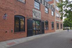
andre.chiquit.ooo
|
Rock climbing gym with showers included.
|
River Rock | 37.26349, -79.95775 | |
|
||||
|
scott.berger715
|
Still only one small upper spring available. if there is a car in the parking lot already, either expect a wait or turn around. showed up at 7am on a Tuesday and the people in already weren't in a rush to get out so we left. |
Remington Hot Springs | 35.57645, -118.55299 | |
|
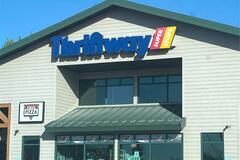
goupil4
|
Gaz - corner store - pizza - Subway - Broadway Brew |
Conoco Thriftway | 45.85363, -111.33672 | |
|
||||
|
doomhawk
|
This site is perched on top of a hill with incredible views. Surrounded by rolling hill canyons it is a sight to behold. 99% of the way is a smooth gravel road with the last section to the site a bit bumpy but nothing too much and no rocks.
|
Rolling Ridge | 45.85572, -117.39223 | |
|
||||
|
bongoboy
|
No spigot in this spot ! Wonder where it is. Unfortunately |
Spring Hill Natural Spring | 46.85543, -113.88346 | |
|
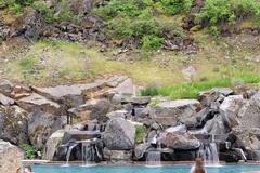
noriduelores
|
Day pass for use of hot springs. 7! pools ranging in temperature. Hot shower, complimentary toiletries, locker, and wifi all included for $18. I meantioned I was only passing through and was offered a towel. However, I don't think this is standard and is probably best to bring your own. On sight tavern, gift shop and lodging if you choose to stay. Rooms are $300+. I only enjoyed the pools and shower. No AT&T cell reception. |
Quinns Hot Spings Resort | 47.33096, -114.79014 | |
|
||||
|
janed9640
|
The bathrooms/dump station are clean. There’s water for rinsing and a separate faucet marked with ‘Water’, we assumed it’s potable water and filled it with the tank. |
Free water and dump station | 44.41395, -104.33893 | |