Check-Ins
| When? | Who? | Comment | Place | Location |
|---|---|---|---|---|
|
jlgp12330
|
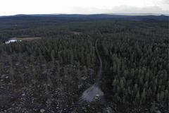
The place is very good, near to houses, near to main roàd from ALTAMIRA to TIMANA, Huila Department. |
Tarqui Crossroad | 2.06841, -75.81274 | |
|
mandy.lynch
|
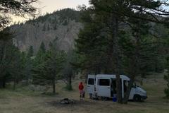
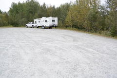
Nice site for one rig and a couple of tents.Amazing views of Linville Gorge. This site is right off of Old NC 105 so had some traffic late into the night. Has fire ring |
Old NC 105 Camp Site | 35.80568, -81.93753 | |
|
||||
|
nolongerworkingat55
|
electric running water beautiful views of the lake |
Meziadin Lake Provincial Park | 56.08683, -129.30679 | |
|
philliploehnert
|
The square is at the end of a fork in a dirt road. If you want to be alone this is the perfect place. |
On the Wild Side | 60.65571, 13.11587 | |
|
||||
|
fortin.penelope
|
nice and quiet. it was raining so we didn't go to the beach. |
Deep River Lamure Beach | 46.10245, -77.47867 | |
|
krcasdorph
|
This is the spot! A Lot of people sleeping here! No one bothered us. Very one was very quite and respectful. The highway is right there so it was a bit loud. It did quit down but then picked up agin in the morning. |
Dismal Nitch Rest Area | 46.24921, -123.86066 | |
|
michelpaulcote1594
|
Il y avait 31 véhicules la nuit dernière, stationnés sur le quai et les espaces ouverts près du quai. Ai demandé aux policiers qui patrouillaient: 'camping 'toléré'. Endroit était très propre et calme, malgré l'achalandage. Il n'y a pas de traversier en 2020 à cause de la Covid. |
ferry Harbour | 48.34495, -69.39048 | |
|
Katie
|
I stayed at the Riverside campground - I reserved ahead of time via Reserve America for $23, which included the campsite and parking space. It is a 2 min drive from I-80 whereas the other campgrounds were another 15-20 min drive. There were multiple unisex vault toilets and pumps for potable water, but no showers or cleaning stations at this site. Each site has its own fire pit and bbq station. Right outside the entrance, there was a stand with firewood you can buy (no one attending - you just leave your money in a box).
|
Rockport State Park | 40.77475, -111.38700 | |
|
alex.redburg
|
This place is quite cute. Room enough for one. Out in the middle of nowhere. |
Müllerin Creek | 45.08700, -110.84333 | |
|
||||
|
instagram.com/plansintransit
|
About 5 miles of gravel off the paved road to an eerie looking abandoned structure. The arch is pretty cool and there’s a pretty level spot to park. Overall would recommend! |
Ghost Town | 41.22796, -115.06046 | |
|
lolinkev.tt
|
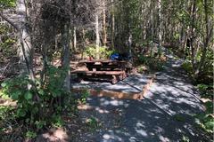
One of the most beautiful road pullout in the «Bas-Saint-Laurent». Washrooms and picnic tables (at least 5 or 6, placed on different levels and far away from each other) are accessible all year long. Astonishing sunsets make this place a must when travelling to Gaspesie!! |
Belvédère et halte routière de Saint-Narcisse | 48.28592, -68.37605 | |
|
||||
|
itsnotlevel2
|
This is an informal tent camping spot on top of Unaka Mountain. Access here to the Appalachian Trail. A good bit of traffic as far as people goes and of course cars to drive about 2 ish miles "up" a gravel rd. Im in a Promaster and I made it no problem and it was wet and a little rain on the way up. 4-5Mbps download and about 1.5up so Verizon signal is really good considering. There is a turn around when you get to the top but only 1 or 2 level spots. One under some trees and one on the far side of the turn around. I arrived at night and it was foggy so I couldn't see anything. Stayed one night. Nothing here but a gravel road so bring what you need and take what you use.... leave no trace. |
Beauty Spot Unaka Mountain | 36.11757, -82.33279 | |
|
Rambo
|
This site also has dump station and potable water for RV, no charge. We used it several times over four weeks in August and September. Also nice general store with gas and free wi-fi. |
Showers @ Signal Mountains Campground | 43.84238, -110.61162 | |
|
naomi.mbanefo92
|
Super easy to find, right off the road which was a surprisingly busy road. Camping area was nice with fire pits on a small, beautiful calm lake. We camped on a Saturday night and got woken up numerous times until about 2am by teenagers causing a raucous. Felt a bit unsafe at times, but was free and accessible in our 30ft motorhome. |
Mineral Lake | 49.34989, -115.85566 | |
|
MotorPilgrim
|
this is an amazing spot... the grass is cut tall so someone is keeping an eye on it. There is a bit of debris and some trash around but not enough to spoil it. .. I'm here in early september and I haven't seen another person in 2 hours. I cooked a steak here and ate while the sunset over the lake. Road is easy a cess. advise staying on the road in case of nails |
Manitou Lake grassy overlook and beach | 52.78243, -109.63099 | |
|
||||
|
elli
|
next to the street. nobody here
|
Lac De Saint Pardoux | 46.01867, 1.35317 | |
|
||||
|
halosz
|
Great find! Warm spring was delightful. Didn’t use the showers or potty, we are self sufficient. Check out the gorge 2 miles down the road out of the cg. Opal mines are a draw but you can buy rather than dig. Great sunrises and sets, cool mornings, early fall. Loved it and stayed a 2nd night. Free is a bargain!!! |
Virgin Valley FREE Campground | 41.85329, -119.00190 | |
|
angelwelp
|
Free water spigot near anglers access parking on side of road. |
Free Water | 44.05636, -71.13984 | |
|
angelwelp
|
Great dispersed camping area, I found the only open spot that worked perfectly for my Class C mini motorhome. Near the river and some walking trails. Only the first few spots appear to have service. There was none where I went. |
Forest Road 17 Pulloffs | 44.13371, -71.11206 | |
|
gilbuzzi
|
lugar muito bonito, limpo e organizando.
|
Camping Selim de Prata | -27.14961, -49.56306 | |
|
WAYNE
|
Excellent spot...very large parking area just beyond the bridge down by the water.
|
boat launch @ Smooth Rock Falls | 49.27480, -81.63600 | |
|
||||
|
chantelhb
|
Fine for a night. There is a water spigot over by the horse area ( East end) |
Brothers Rest Area | 43.81290, -120.59839 | |
|
||||
|
chaostours.ch
|
Lovely place where you only meet fisher men, farmers and mosquitos. Access by narrow, very steep but paved road. |
Lonely place close to a lake | 39.60296, 16.28814 | |
|
||||
|
rilopez825
|
Buck Lake is a group camping facility in the heart of Ocala National Forest in Florida. Great for family reunions and social gatherings, the campground can host a group of up to 50 guests along the shores of Buck Lake. Activities include fishing, boating, picnicking, hiking and simply relaxing and enjoying the breeze. |
Buck Lake Group Campground | 29.09803, -81.65173 | |
|
||||
|
rilopez825
|
Quiet, Peaceful, Secluded. One Place I'll definitely revisit. |
Buck Lake Group Campground | 29.09803, -81.65173 | |
|
helge.0509
|
stayed 3 nights
great birding spot |
Kliphoek River Resort | -32.83217, 18.20805 | |
|
nolachen
|
Big wide open space for camping. Close to the salt flats |
Nice big flat spot on top of a light hill | 40.80271, -114.00229 | |
|
benjali.ali
|
29 campsites $13 a night. Beautiful forest setting with toilet s and RV dump.hiking trails. |
Mason Ridge Campground | 39.32925, -86.42308 | |
|
||||
|
phil
|
There are some small 'no tents' signs to indicate no camping but no real other signage like in other national parks, so we spent the night. After the hike a warden knew we were here overnight and gave us a friendly warning that there is no camping in any of the national park car parks. Assume this also means some of the unofficial car parks up the road with no signs (eg at taff trailhead) but you might be OK there. |
Blaen y Glyn Uchaf car park | 51.84917, -3.37091 | |
|
instagram.com/thesinginggoldsmith
|
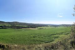
Gorgeous Parks Canada spot called “The Landscape of Grand Pre.” Has a big parking lot, and picnic area. Didn’t see any “No” signs either, so possibly good for staying overnight. (I only spent about 3 hours here mid-day reading and taking in the gorgeous scenery). Busy but quiet spot. |
Grand Pre Lookoff | 45.10341, -64.31180 | |